4DMED-Hydrology
Developing an advanced, high-resolution, and consistent reconstruction of the Mediterranean terrestrial water cycle
4DMED-Hydrology
Project Summary
4DMED-Hydrology aims at developing an advanced, high-resolution, and consistent reconstruction of the Mediterranean terrestrial water cycle by using the latest developments of Earth Observation (EO) data as those derived from the ESA-Copernicus missions. In particular, by exploiting previous ESA initiatives, 4DMED-Hydrology intends:
1. to demonstrate how this EO capacity can help to describe the interactions between complex hydrological processes and anthropogenic pressure (often difficult to model) in synergy with model-based approaches;
2. to exploit synergies among EO data to maximize the retrieval of information of the different water cycle components (i.e., precipitation, soil moisture, evaporation, runoff, river discharge) to provide an accurate representation of our environment and advanced fit-for-purpose decision support systems in a changing climate for a more resilient society.
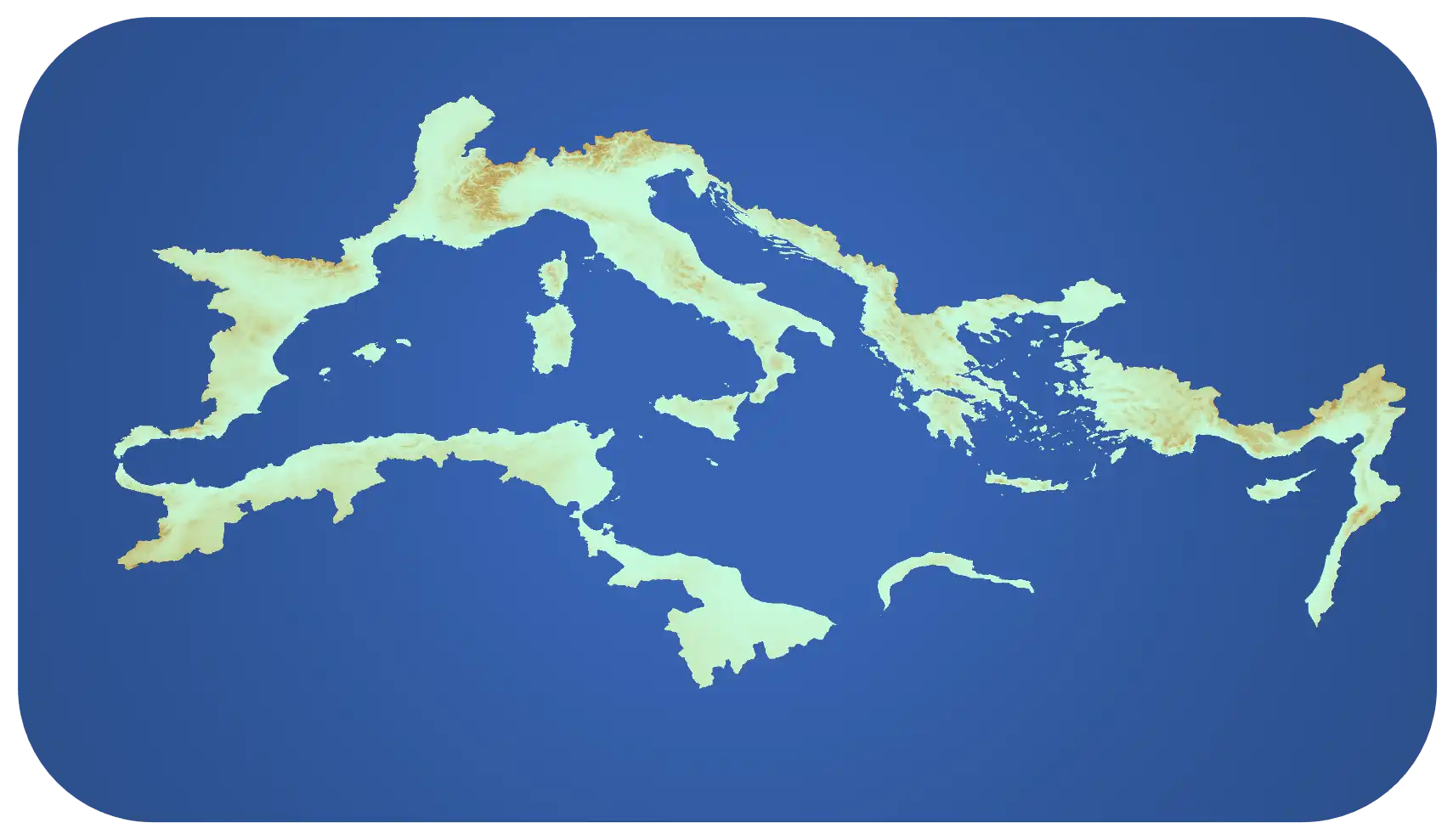
4DMED-Hydrology will focus on four test areas, namely the Po river basin in Italy, the Ebro River basin in Spain, the Hérault River basin in France and the Medjerda River basin in Tunisia, which are representatives of climates, topographic complexity, land use, human activities and hydrometeorological hazards of the Mediterranean Region (MR). The developed products will be then extended to the entire region. The resulting EO-based products (i.e., experimental datasets, EO products) will be made available in an Open Science catalogue hosted and operated by ESA.
ESA Contract No. 4000136272/21/I-EF
Project PI: Christian Massari


Period: January 2022 – December 2023 (24 months)
Partners: The consortium is leaded by CNR-IRPI (Perugia, Italy) with the collaboration of 9 partners:
Vienna University of Technology (TUWIEN, Austria)
Ghent University (UGent, Belgium)
CIMA Research Foundation (CIMA, Italy)
ESTELLUS SAS (ESTELLUS, France)
Observatori de l’Ebre (OBSEBRE, Spain)
Katholieke Universiteit Leuven (KULeuven, Belgium)
VANDERSAT B.V. (VANDERSAT, Nederland)
EURAC Research – Accademia Europea di Bolzano (EURAC, Italy)
HydroSciences Montpellier (Institut de recherche pour le développement) (HSM, France)
Background
The Mediterranean Region (MR) includes the largest semi-enclosed sea on Earth and is an area of both exceptional biodiversity value and intense and increasing human activities. MR has a unique character as it is located in a transition zone between temperate, cold mild-latitudes and the tropics with several large-scale atmospheric oscillations/teleconnection patterns. This determines a high temporal variability of climate which causes periods of excess water with widespread floods followed by long drought episodes and heat waves, making the region highly vulnerable to hydrological extremes. Therefore, resolving the water cycle over the MR is central for protecting people and guaranteeing water and food security.
Previous efforts to resolve the water cycle in the MR have mainly used model outputs or reanalysis and in situ data networks. In this context, the European Space Agency (ESA) has supported significant scientific efforts to advance the way we can observe and characterize the Mediterranean water cycle from satellites with Watchful, Irrigation+, and WACMOS-Med projects. For instance, the WACMOS-Med considered a number of novel techniques to ensure that the different components of the Mediterranean water cycle could be estimated from satellite observations while minimizing the residual errors. WACMOS-Med provided a clear assessment of the different limitations of current satellite technology to characterize in a consistent and accurate manner the different components of the water cycle. However, limitations associated to resolution in space and time, accuracies, uncertainty definition and inter-product consistency hinder the practical use of the products for operational application in several domains (e.g., agriculture, water resource management, hydro-climatic extremes and geo-hazards) over the MR.
4DMED-Hydrology will go beyond this by:
1) developing high-resolution (1 km, daily, 2015–2021) EO-based datasets of the different components of the water cycle;
2) merging these datasets to obtain land water budget closure and providing a consistent high-quality merged dataset;
3) addressing major knowledge gaps in water cycle sciences and society.
News
1. We published 4DMED project – Hydrological ground validation datasets: CLICK HERE
2. ESA has approved the Network of Resource sponsor for 4DMED-Hydrology project.
3. New 4DMED-Hydrology dataset available here
Datasets
Publications
Quast, R., Wagner, W., Bauer-Marschallinger, B., & Vreugdenhil, M. (2023). Soil moisture retrieval from Sentinel-1 using a first-order radiative transfer model—A case-study over the Po-Valley. Remote Sensing of Environment, 295, 113651.
https://doi.org/10.1016/j.rse.2023.113651
Brocca, L., Zhao, W., & Lu, H. (2023). High-resolution observations from space to address new applications in hydrology. The Innovation, 4(3), 100437.
https://doi.org/10.1016/j.xinn.2023.100437
Schellekens, J., Kramer, T., van Klink, M., van der Schalie, R., Malbeteau, Y., Geers, A., & de Jeu, R. (2023). A 1km experimental dataset for the Mediterranean terrestrial region of Soil Moisture, Land Surface Temperature and Vegetation Optical Depth from passive microwave data (V4.1) [Data set]. Zenodo.
https://doi.org/10.5281/zenodo.7684993
Hulsman, P., Keune, J., Koppa, A., Schellekens, J., & Miralles, D. G. (2022). Incorporating plant access to groundwater in existing global, satellite-based evaporation estimates [Preprint]. Hydrology. https://doi.org/10.1002/essoar.10512478.1
De Lannoy, G. J. M., Bechtold, M., Albergel, C., Brocca, L., Calvet, J.-C., Carrassi, A., Crow, W. T., de Rosnay, P., Durand, M., Forman, B., Geppert, G., Girotto, M., Hendricks Franssen, H.-J., Jonas, T., Kumar, S., Lievens, H., Lu, Y., Massari, C., Pauwels, V. R. N., … Steele-Dunne, S. (2022). Perspective on satellite-based land data assimilation to estimate water cycle components in an era of advanced data availability and model sophistication. Frontiers in Water, 4. https://www.frontiersin.org/articles/10.3389/frwa.2022.981745
Victor Pellet, Filipe Aires, Lorenzo Alfieri, Giula Bruno: A physical/statistical data-fusion for the dynamical downscaling of GRACE data at daily and 1km resolution [under review in Journal of Hydrology]
Girotto, M., Formetta, G., Azimi, S., Bachand, C., Cowherd, M., De Lannoy, G., Lievens, H., Modanesi, S., Raleigh, M. S., Rigon, R., and Massari, C.: Identifying snowfall elevation patterns by assimilating satellite-based snow depth retrievals, Science of The Total Environment, 906, 167312, https://doi.org/10.1016/j.scitotenv.2023.167312, 2024.
McDermid, S., Nocco, M., Lawston-Parker, P., Keune, J., Pokhrel, Y., Jain, M., Jägermeyr, J., Brocca, L., Massari, C., Jones, A. D., Vahmani, P., Thiery, W., Yao, Y., Bell, A., Chen, L., Dorigo, W., Hanasaki, N., Jasechko, S., Lo, M.-H., … Yokohata, T. (2023). Irrigation in the Earth system. Nature Reviews Earth & Environment, 1–19.
https://doi.org/10.1038/s43017-023-00438-5
Busschaert, L., Bechtold, M., Modanesi, S., Massari, C., Brocca, L., & Lannoy, G. J. M. D. (2023). Irrigation quantification through backscatter data assimilation with a buddy check approach [Preprint]. Preprints. https://doi.org/10.22541/essoar.167590826.62059121/v1 (Under review)
Bechtold, M., Modanesi, S., Lievens, H., Baguis, P., Brangers, I., Carrassi, A., Getirana, A., Gruber, A., Heyvaert, Z., Massari, C., Scherrer, S., Vannitsem, S., and Lannoy, G. D.: Assimilation of Sentinel-1 backscatter into a land surface model with river routing and its impact on streamflow simulations in two Belgian catchments, Journal of Hydrometeorology, 1, https://doi.org/10.1175/JHM-D-22-0198.1, 2023.
Bartkowiak, P., Castelli, M., Ventura, B. and Jacob, A., 2023. Large scale two-source energy balance modelling of evapotranspiration over Mediterranean region. In EGU23 General Assembly.
Bartkowiak, P., Castelli, M. and Notarnicola, C., 2023. Potential of Sentinel-3 LST downscaling for estimating evapotranspiration from two-source energy balance model at sub-kilometer spatial resolution. In International Workshop on High-Resolution Thermal EO.
Massari et al. 2022. 4DMED-Hydrology: capitalizing high resolution Earth Observation data for a consistent reconstruction of the Mediterranean terrestrial water cycle. Living Planet Symposium Session, Bonn, 23-27 May 2022.
Avanzi et al. : How much snow is there across the Mediterranean region? IGS International Symposium on Snow Davos, September 2022.
Rains, D., Trigo, I., Dutra, E., Ermida, S., Ghent, D., Hulsman, P., Gómez-Dans, J., and Miralles, D. G. High-resolution all-sky land surface temperature and net radiation over Europe, submitted to Earth System Science Data (ESSD). (Submitted)
Zhong, F., Jiang, S., van Dijk, A. I. J. M., Ren, L., Schellekens, J., and Miralles, D. G.: Revisiting large-scale interception patterns constrained by a synthesis of global experimental data, Hydrol. Earth Syst. Sci. Discuss., https://doi.org/10.5194/hess-2022-155, 2022.
